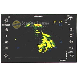
Offering a unique combination of increased situational awareness, enhanced safety and wide-ranging capability, the KMD 150 Color Multifunction Display gives you bigscreen performance in a package that fits your panel—and your budget.
Designed specifically for use in piston-powered and light turbine aircraft, the KMD 150 features a high-resolution color display, a safety-enhancing terrain database, the capacity to display a variety of aeronautical and cartographic information simultaneously, an easy-to-use joystick controller, and newly implemented Victor Airways. In short, the new KMD 150 offers a unique combination of performance and value.
- Color MFD moving map for enhanced situational awareness
- Available without an internal GPS unit for use with existing GPS/Loran units
- High-resolution, color TFT active-matrix display
- Outstanding sunlight readability with wide viewing angle
- Customizable Jeppesen® aeronautical database
- Enhanced cartographic database
- Regional topographical/elevation information
- High-speed, high-capacity front-loading PCMCIA data card
- ‘North-up’ and ‘track-up’ operation
- Intuitive, easy-to-use soft-key operating system
- Unique joystick control for data entry and “more information” feature
- On-screen “Help”
- Autopilot interface
- Incorporates E6B calculator function for density altitude, trip planning and fuel planning
- Multilingual capability offers English, French, Spanish and German, along with on-screen airport listings in either plain language or ICAO code
- Mounting: Rack-mounted
- Height: 4.0 in. (10.1 cm)
- Temp Rating: -20°C to +55°C continuous
- Maximum Altitude: 25,000 ft.
- Screen Size: 5-in. (12.7 cm) diagonal
- Weight: 3.3 lbs. (1.75 kg)
- Cartographic: Coastlines, cities, major towns, urban areas, railroads, roads, lakes and rivers
- Power Required: 10-33 VDC (15 W max.)
- Width: 6.2 in. (15.8 cm)
- Length: 6.9 in. (17.5 cm)
- Topographic: Digital Terrain Elevation Data (DTED) published by the National Imaging and Mapping Agency (NIMA), a part of the United States Geological Survey (USGS)
- GPS Engine: 8-channel parallel
- Aeronautical: ARINC 424 format VORs, NDBs, airfields, runway information and graphics, communicating frequencies, airways intersections, danger areas and upper/lower controlled airspace limits (Jeppesen)


