
What’s the big deal about touchscreen avionics?
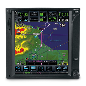
Pilots who love their Garmin GNS 530 systems are quickly discovering why the GTN 750 is even better.
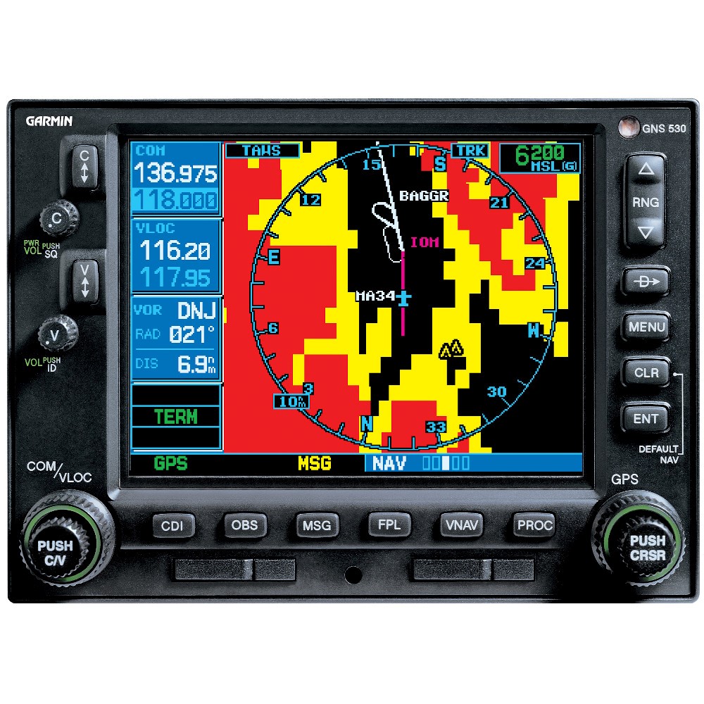
We understand the attachment that pilots have for their hard-working, great-performing GNS 530W navigators. These units have set the standard in nav/comm/GPS integration for well over a dozen years. And truth be told, if touchscreen technology were only about replacing button-pushing and knob-twisting with finger taps on a screen, you probably wouldn’t see that much advantage in trading up to the GTN series. But the touchscreen interface is truly so much more than that. It eliminates layers of complexity, adds extensive MFD functions, simplifies flight planning and navigation, and opens up whole new worlds of capability that we’ve only just begun to explore.
In the chart below we offer just a few examples of the many comparative advantages the GTN 750 can bring to your avionics stack:
| Product comparison: | GTN 750 | GNS 530W |
| Simple, centralized and intuitive touchscreen pilot interface | Yes | No |
| Sleek, modern, streamlined design with fewer mechanical knobs, buttons, and switches to learn | Yes | No |
| Display type | Full color TFT LCD | 8-color TFT LCD |
| Display size (GTN 750 is nearly 100% larger) | 4.46”W x 5.27”H | 4”W x 3”H |
| Display resolution (GTN 750 has over 550% more pixels) | 600 x 708 pixels | 320 x 234 pixels |
| Reduce panel space with remote avionics | Yes | No |
| Ability to control remote audio panel | Yes | No |
| Ability to control remote transponder | Yes | No |
| Airway navigation | Yes | No |
| Geo-referenced approach charts right on the moving map page | Yes | No |
| Graphical flight plan editing; “Rubber banding” | Yes | No |
| Geo-referenced SafeTaxi diagrams that overlay on the moving map page for many airports in the U.S. and Europe | Yes | No |
| Ability to display and control weather radar like never before | Yes | No |
| Advanced ADS-B “In” Display (ADS-B symbology, TargetTrend™ relative motion, Surface application, weather products and more) | Yes | No |
| Optional Worldwide Weather, Voice, Text Messaging | Yes | No |
| High Resolution Terrain | Yes | No |
| Advanced weather features (including Canadian WX, cloud tops, Sigmets/Airmets, city forecast, WX forecast, icing potential, turbulence, Pireps/Aireps, and more) | Yes | No |
| PilotPak eligible, databases for the entire aircraft, for a single annual price | Yes | No |
| Heading and altitude leg types allow select autopilots to fly missed approaches and other leg types | Yes | No |
What’s the value difference between GTN and GNS?
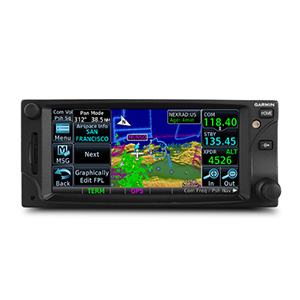
Pilots who’ve flown the Garmin GNS 430W are now finding even more to love in the touchscreen GTN 650.
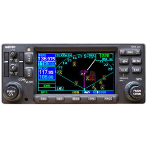
For years, the trusty Garmin GNS 430W series has proven to be a game-changing, all-in-one comm/nav/GPS package that does a lot of things amazingly well. So why, loyal owners ask, should they consider trading up to the newer GTN 650 touchscreen systems? The short answer: You still get the great things the GNS 430 can do – PLUS you get a much simpler, centralized and more intuitive user interface, a “shallower” menu structure, and a wealth of innovative features and capabilities that take graphical flight planning, systems management and GPS guidance technology to whole new levels of utility. Touchscreen control not only streamlines tuning and mode selection – but, in effect, lets pilots utilize the GTN 650 as a virtual flight management system.
For more examples of the added value provided with Garmin's GTN avionics, just take a look at the comparison chart below:
| Product comparison: | GTN 650 | GNS 430W |
| Simple, centralized and intuitive touchscreen pilot interface | Yes | No |
| Sleek, modern, streamlined design with fewer mechanical knobs, buttons, and switches to learn | Yes | No |
| Display type | Full color TFT LCD | 8-color DSTN LCD |
| Display size (GTN 650 is nearly 50% larger) | 4.46”W x 1.98”H | 3.3”W x 1.8”H |
| Display resolution (GTN 650 has over 400% more pixels) | 600 x 266 pixels | 240 x 128 pixels |
| Reduce panel space with remote avionics | Yes | No |
| Ability to control remote transponder | Yes | No |
| Airway navigation | Yes | No |
| Graphical flight plan editing; “Rubber banding” | Yes | No |
| Advanced ADS-B “In” Display (ADS-B symbology, TargetTrend™ relative motion, Surface application, weather products and more) | Yes | No |
| Optional Worldwide Weather, Voice, Text Messaging | Yes | No |
| Geo-referenced SafeTaxi diagrams that overlay on the moving map page for many airports in the U.S. and Europe | Yes | No |
| High Resolution Terrain | Yes | No |
| Advanced weather features (including Canadian WX, cloud tops, Sigmets/Airmets, city forecast, WX forecast, icing potential, turbulence, Pireps/Aireps, and more) | Yes | No |
| PilotPak eligible, databases for the entire aircraft, for a single annual price | Yes | No |
| Heading and altitude leg types allow select autopilots to fly missed approaches and other leg types | Yes | No |