Update your Cessna Citation CJ2 with an all Garmin retrofit, and add a revolution in flight technology at your fingertips.
You'll fly with modern, faster, sharper TXi™ flight displays. TXi EIS that integrates with your turbofan engines to help reduce
pilot workload. A GFC™ 600 autopilot that adds safety features and fully-coupled vertical navigation (VNAV) capabilities. And a
state-of-the-art weather radar that automatically adjusts scans to help you better understand weather activity along your route.
Plus, you’ll modernize your aircraft to increase your reliability and reduce avionics maintenance concerns — so you can extend
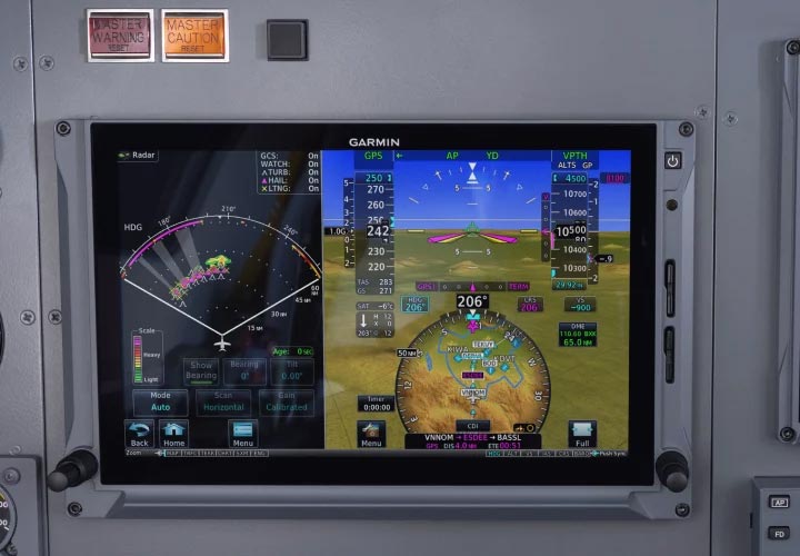
the life of your airframe. G600 TXi flight displays revolutionize how you view flight information, with a touchscreen interface and advanced PFD/MFD
capabilities.
Primary flight data is displayed with a wide horizon for optimal awareness in instrument conditions. The PFD offers a map view on
the HSI
to show NEXRAD imagery and weather inputs from ADS-B and SiriusXM® datalinks1 — as well as SafeTaxi® airport diagrams,
traffic,
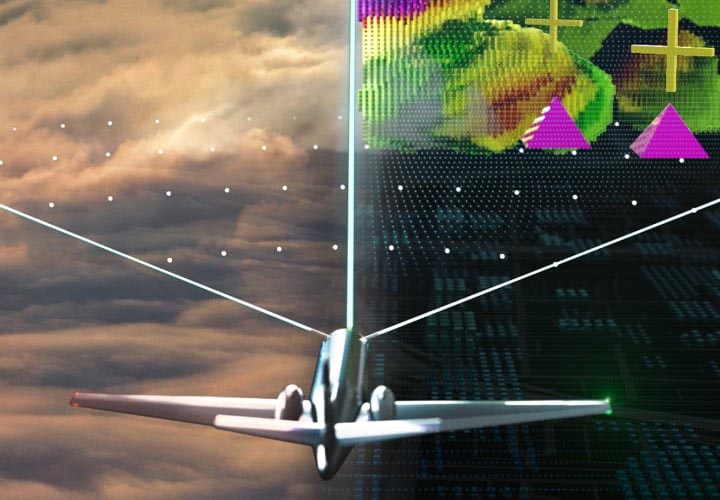
terrain and more. Garmin SVT™ synthetic vision technology provides a 3D virtual reality-like view of terrain and water features,
obstacles and more to give you a realistic visual frame of reference — especially in IFR, marginal VFR or nighttime conditions.
Additionally, new
CJ2-specific features include stabilized approach cues and audible V-speed callouts to make flying single pilot even easier. Plus, each display is pilot-configurable into 60/40 PFD/MFD, so you can view terrain and obstacles, airspace boundaries, navaids,
flight
plan routing, georeferenced FliteCharts® and more (optional Jeppesen® electronic charts are also available). You can also view a
wide
range of weather solutions — from weather radar returns via a GWX™ 8000 auto mode-enabled radar to Stormscope® lightning detection
to animated NEXRAD imagery from various satellite or ADS-B ground network links1. And you can integrate a variety of
traffic-alerting technologies — ADS-B “In” traffic depicted with TargetTrend™ relative motion technology and TerminalTraffic™
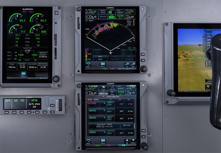
airport surface monitoring as well as active traffic surveillance systems. GTN Xi navigators add next-generation GPS/NAV/COMM capabilities to your CJ2. These WAAS/SBAS-certified GPS receivers enable
GPS-guided
LPV glidepath approaches down to ILS-comparable minimums as low as 200’ — as well as advisory Visual Approach guidance to even
more
runways. GTN Xi supports and enables coupled descent VNAV when paired with your GFC 600 autopilot — and even lets you easily
create and
execute holding patterns over a published or user-defined waypoint. Graphical routing lets you visualize your entire flight plan,
including departures, arrivals, visual/instrument approaches and more. And for simplified IFR routings, you can view airway
segments
available from a waypoint as well as corresponding exit options. You can also wirelessly load flight plans and database updates
with an
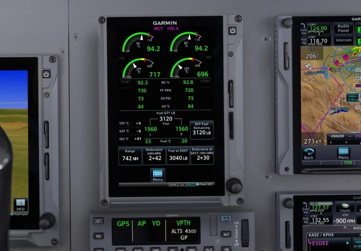
optional Connext® link — and even display radar returns on GTN 750Xi when paired with your GWX 8000 weather radar. TXi EIS replaces the legacy EIS solution and features a newly refined gauge layout and user interface. Manually determining power
settings are a thing of the past with EIS-generated or user-selected N1 targets for takeoff, go-around and max continuous thrust
settings. N1 reference bugs, which take into account engine and anti-ice status as well as outside air temperature, are computed
automatically and
integrated into the TXi EIS display. Pilot-defined N1 reference bugs are also available in the system. Additionally, CJ2 pilots
can take
advantage of integrated start timers on the TXi EIS display, helping pilots respect transient engine limitations during the engine
start.
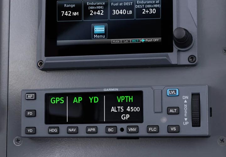
The GFC 600 digital autopilot delivers CJ2 pilots superior in-flight characteristics and new operational capabilities such as
VNAV
descents, fully coupled go-around capability, and much more. Garmin’s Electronic Stability and Protection (ESP) for the CJ2 takes
into
account flap position and the aircraft stick shaker to more precisely activate underspeed protection and other ESP capabilities.
Guidance
from the GTN 750Xi allows the GFC 600 to fly fully-coupled VNAV descents leading to a wide range of precision, non-precision and
GPS-guided approaches –– as well as holds, procedure turns, and more. The CJ2 solution also features Emergency Descent Mode (EDM).
In the
event of a loss of cabin pressurization, EDM is capable of automatically descending the aircraft to a preset altitude without
pilot
intervention to help avert hypoxic situations. A color display and flight level change (FLC) mode round out new GFC 600 features
on a
modernized mode controller for this installation. Weather radar operation has always been a difficult and technical task. Auto mode takes that stress away. Set the range, and the
radar
automatically adjusts tilt and gain settings to accurately profile weather cells, so you can determine the actual size, shape and
hazardous storm cell activity — and more accurately assess threat potential so you can deviate and avoid. Plus, it offers zero
blind range
to aid in the identification of storm cells in close proximity, lightning and hail prediction, turbulence detection and enhanced
ground
clutter suppression. The radar’s high-definition color palette can display up to 4 times as many colors as traditional weather radars, providing a far
clearer
depiction of where you can find holes in the weather or what you must avoid completely. It also integrates with TXi flight
displays and
GTN 750Xi navigators for display radar return display — and, when equipped with dual TXi PFDs and GTN 750Xi navigators, it allows
both
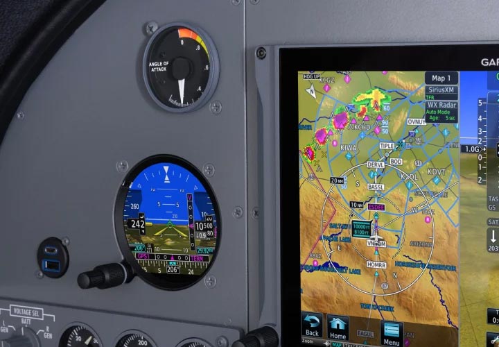
pilots to view different radar returns for the ultimate in situational awareness. Your updated panel is completed with a GI 275 standby flight instrument that features optional SVT™ synthetic vision. The bright,
high-resolution touchscreen is sunlight-readable and maximizes the available space with an edge-to-edge display. And it provides
up to 60
minutes of backup battery power, so you’ll feel confident knowing you’ll get home. Managing a jet is hard work. It takes time, effort and preparation to keep your aircraft ready for flight. PlaneSync helps
simplify the
complexities of aircraft management. Using 4G LTE cellular or Wi-Fi® connectivity provided by the GDL® 60 datalink, it interfaces
with supported avionics and devices to let you keep tabs on your aircraft from virtually anywhere3, 4. Forget juggling database update cycles or transferring databases to data cards. With PlaneSync technology, your avionics and
databases
are kept ready to go whenever you are. You can even check your system’s update status remotely via your Garmin Pilot™ smart-device
app.
Plus, you can determine whether your aircraft is serviced and ready to go. When appropriately equipped, PlaneSync allows you to
check4 Hobbs and flight times, fuel quantity, battery voltage, OAT, oil temperature and aircraft GPS location5 via the
aircraft
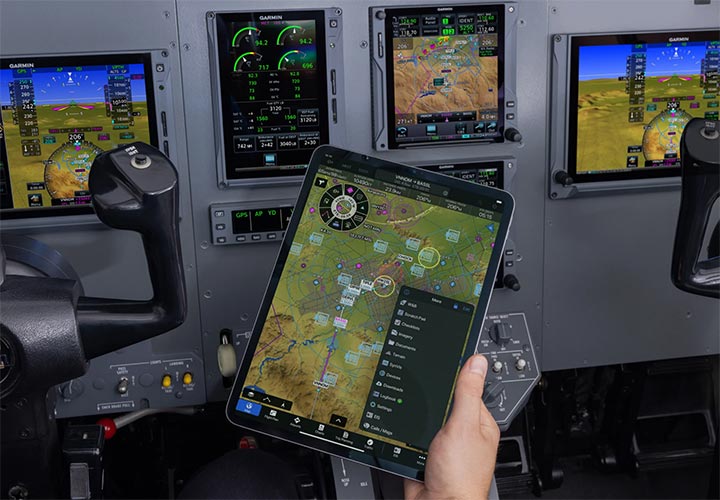
dashboard on Garmin Pilot. And you can save vital time on flight planning by using flight apps such as Garmin Pilot and ForeFlight on your mobile device to
create
and file your flight plan from the comfort of your home or office. Then, once at the airport, you can quickly upload the waypoint
data from your device to your avionics. In no time, you’re ready to activate your flight plan and go flying. 1 Weather streaming requires compatible ADS-B or
SiriusXM datalink; traffic streaming requires compatible ADS-B datalink; ADS-B available in U.S. only.MODERN. RELIABLE. TAILORED FOR YOUR CJ2.
G600 TXi FLIGHT DISPLAYS
GTN™ Xi NAVIGATORS
TXi EIS
GFC 600 AUTOPILOT
GWX 8000 STORMOPTIX™ WEATHER RADAR WITH AUTO MODE
GI 275 STANDBY FLIGHT INSTRUMENT
PLANESYNC™ TECHNOLOGY
2 Optional
feature;
additional hardware required.
3 Active PlaneSync and database subscriptions required
for automatic database updates. Active PlaneSync
subscription plan required for flight log uploading. Features are available on-ground only and require GDL 60 to have active LTE
or
Wi-Fi connectivity; signal strength and other factors may apply. See Garmin.com/PlaneSyncCoverage for LTE coverage
details.
4 Remote aircraft status requires active PlaneSync subscription. User’s smart device must have internet
connectivity. Feature is available on-ground only and requires GDL 60 to have LTE connectivity; signal strength and other
factors may
apply. See Garmin.com/PlaneSyncCoverage for coverage details.
5 GPS location provided by avionics. Select avionics can
provide
live location with a compatible GPS antenna; otherwise, location displayed will be based on the avionics last known location.
GPS signal
strength and other factors may apply.


